|
Here's a collection of the best and must-see places in Puerto Rico that are often not known by regular tourists.
Please enjoy to explore the island and its truly mystical places. |
|
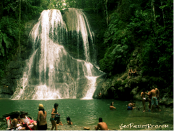
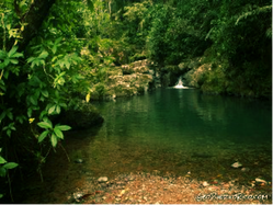
Gozalandia, San Sebastian
Maybe the prettiest well-known waterfall, 50+ feet high with a deep pool to bath in. There is another smaller waterfall upstream that you can find if hiking east. GPS: 18.3609, -66.9831. https://goo.gl/maps/167RauDvrz52 |
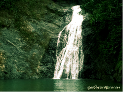
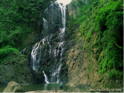
Salto Curet, Maricao
Waterfall composed of a couple sequential falls. Main one is over 40 feet tall and falls into a nice swimming pool. GPS: 18.1652, -66.95425. https://goo.gl/maps/pxVAp53WBKC2 |
La Niebla, Aibonito
One of the tallest in the island, about 250 foot high and located in Cańón San Cristobal. If you feel like swimming I recommended it farther away downstream. GPS: 18.1596, -66.3022. https://goo.gl/maps/p2zTpJorpEt |
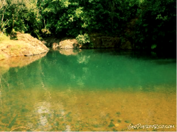
Charco Confesora, Orocovis
More of a river pool really. It's inside Toro Negro state forest where you can camp out, hike, and enjoy a view from an observation tower. GPS: 18.1769, -66.49583. https://goo.gl/maps/VKgcfkU98Cp |
Charco Azul, Patillas
This pool literally gets blueish when the sun shines. It has a small dam, almost all natural. Located on Bosque Carite State Forest where you can also camp out. GPS: 18.0929, -66.03106. https://goo.gl/maps/GokatgxpbWn |
Charco El Hippie y Canoa Falls, Naguabo
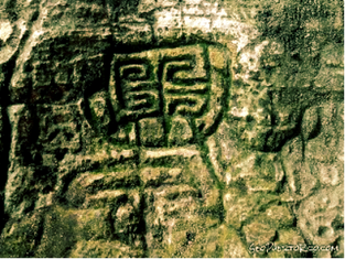
Hippie is a big pool surrounded with smooth whitish rocks. La Canoa Falls forms a little canyon. If you hike downstream you will find some petroglyphs from the Taínos. GPS: 18.2476, -65.7861. https://goo.gl/maps/1jpJDTk6Zq42 |
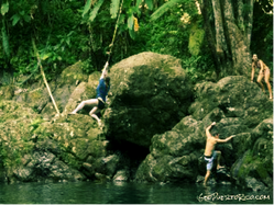
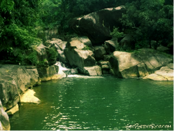
Charco Frio y Las Tinajas, Fajardo
Both a river pool and some waterfalls. Very nice, water here gets the clearest on these dark roundish rocks. You'll also find ropes and a high cliff where people jump from. GPS: 18.2738, -65.73092. https://goo.gl/maps/BayzTAvCW1s |
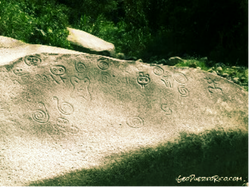
La Piedra Escrita, Jayuya
Twenty five foot wide smooth rock with about 50 petroglyphs. Rock also forms a nice clear greenish pool where people bath. Place has a boardwalk and some facilities. GPS: 18.2169, -66.5737. https://goo.gl/maps/ririSrGcJo82 |
|
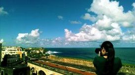
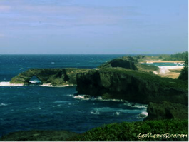
La Cueva del Indio, Arecibo Rare short maritime cave which is also filled with Taíno petroglyphs. On this area, amazing coastal limestone formations form 7 archs, some about 70 foot high. GPS: 18.49205, -66.6416. https://goo.gl/maps/XZFqBZHnmTw |
|

|
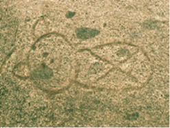
Petroglifos Rio Blanco, Naguabo
Nearby El Hippie and Canoa falls. Map icon and coordinates will place you exactly on top of the petroglyphs' rock. GPS: 18.2467, -65.78587. https://goo.gl/maps/DwBVuFFcPtt |
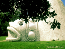
Museo El Cemi, Jayuya
Small museum shaped in the form of a giant Cemí. Adjacent to Casa Canales. A mile away from the La Piedra Escrita. GPS: 18.2098, -66.5616. https://goo.gl/maps/hbeiiXj3eYS2 |
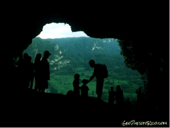
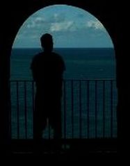
Cueva Ventana, Arecibo
Cave that creates a 30 foot "window" on the wall of a 700 foot high limestone cliff. Incredible view. GPS: 18.3712, -66.6916. https://goo.gl/maps/JJ3XVewc6yv |
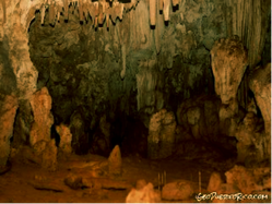
Cueva del Viento, Isabela
Long easily accessible cave within Guajataca State Forest. GPS: 18.4111, -66.97663. https://goo.gl/maps/hVmXFSYe9Gx |